California Soil Mapping in the Early 1900’s
by William R. Reed
EUGENE HILGARD AND MILTON WHITNEY
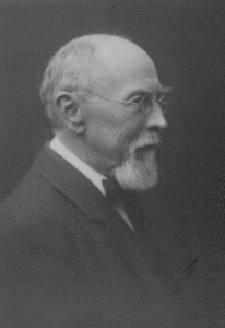 Eugene Hilgard (at left) was a strong proponent of a soil survey of agricultural lands, and as previously noted there was no financial support at that time from the State of California, which resulted in no soil mapping in California. But on the national scene a “Professor” Milton Whitney, who had taught soils courses at the University of Maryland, was installed as the new Chief of the Division of Agricultural Soils in the Weather Bureau of USDA in 1894, with a mission to map soils on agricultural lands across the Nation. Hilgard and Whitney began disagreeing on soil properties and origins from the beginning of the planning of the National Soil Survey in the early 1890s. Whitney, also a geologist, believed that soil fertility was essentially inherent in all soils given the right soil texture and plenty of moisture. Hilgard and many other soil scientists knew that soil chemistry held the keys to soil fertility; soil texture and moisture were only the medium. A battle between the two men ensued that delayed the cooperation of the State of California with the Bureau of Soils. Whitney was under fire from several quarters with his published concepts on soil fertility yet he managed to get the National Cooperative Soil Survey off to a grand start. It is surprising that Whitney did not block Bureau of Soils mapping in California from 1900 on in view of the disagreements with Hilgard. Full official cooperation with California and the Bureau of soils did not occur for another 14 years, after Hilgard was retired. Jenny, Helms, Amundson and others have studied the extensive documentation of the disagreements between Hilgard and Whitney and the reader is referred to these sources for more reading on this interest
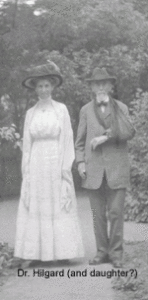 ing subject.
Hilgard criticized the early National Soil Surveys, writing that information on mineralogy, geology, humus, chemical status, acidity and calcium was lacking. (Hans Jenny p.94) Macy Lapham of the early Bureau of Soils (Crisscross Trails p.79) reports that Hilgard was critical of Whitney’s position but was less harmful and vindictive than Dr. Cryil B. Hopkins of Illinois who was the leading critic of Milton Whitney. Macy Lapham and Hilgard became friends of long standing when Macy’s travels brought him to California.
Early soil scientists on the National Soil Survey recognized that the soil data collected was minimal but large areas were covered. Whitney was generally considered as hard to get along with and he surrounded himself with many top-notch scientists only to loose them all to disagreements. The 1903 publication by Whitney and his subordinate, Cameron, Bulletin 22, The Chemistry of the Soil as Related to Crop Productions caused an immediate stir in the soil science world and greatly upset Hilgard. Whitney stated his earlier views, that plant growth was related to moisture and texture and the well known response of fertilizers was simply related to flocculation of the soils allowing plant nutrients to move with soil moisture. Hilgard was convinced that Bureau of Soils soil scientists were trying to undermine his work at the Experiment Station. Apparently it had little real effect on the stations as they expanded in numbers and staff, most of the effects were on Hilgard himself. 1903 and 1904 were particularly trying for Hilgard, as he was part of a movement in the soil science community to have the views of Whitney on soil fertility investigated. Hilgard was then retired, he was the first professor to be affected by the UC’s new mandatory retirement program at age 70, becoming emeritus, and his official role directly against Whitney was reduced yet he still continued to criticize Whitney. The Bureau of Soils continued to expand under Whitney’s direction even with the continued losses of high level soil scientists having major disagreements on soil issues with Whitney.
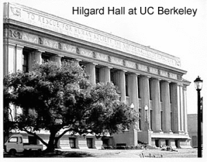 Jenny (1961), writes that Hilgard was eclipsed in his later years as an emeritus by the Whitney group and finally by a new Eastern Dean of Agriculture at Berkeley, who in 1912 brought Dr. Charles Shaw, who had mapped soils under Whitney, to Berkeley. Yet Hilgard’s views on soil chemistry eventually prevailed and Whitney’s views on soil fertility were eventually proved as faulty. The early Bureau of Soils Soil Surveys had limited amounts of data on soil properties and needed subsequent revisions and remapping. After several decades of research, proof would come in the science of plant nutrition that soil chemistry is what drives soil fertility. Hilgard has been named the co-father of soil science with his contribution in the field of soil chemistry. Hilgard’s place as the co-father of soil science appears justified, other writers disagreeing with this position note specific items such as the purported lack of recognition of items such as Chernozems, (I.A. Krupenikov 1992) a dominant Russian soil type but only one of many in North America, as evidence of Hilgard’s limited views on soils, seems unjustified for denying Hilgard’s standing. Unquestionably his standing is immense in California with literally volumes of reports on analyses of soils, waters, and rocks, trials of an enormous list of plants for California agriculture, establishment of the California Experiment Stations and study of the nature and reclamation of alkali soils. The Bureau of Soils National Soil Surveys came to California in 1900, well before a cooperative agreement was signed between the UC and the Bureau in 1913. This may have been more a recognition of the growing value of California agriculture than anything else, already California agriculture was securing the first place status in the nation for an agricultural county and State wide agricultural production was rapidly rising.
MACY LAPHAM
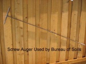
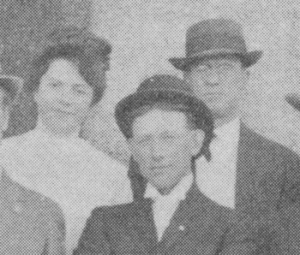 We are indebted to Macy Lapham (at back right) for his history of the earliest Bureau of Soils surveys in California in his famous “Crisscross Trails,” published in 1949. Macy Lapham started with the USDA Bureau of Soils Soil Survey in 1900 and found his way to California the following year. Macy describes the first surveys as using horse and buggy with occasional use of saddle horse for field transportation. Field equipment included a 6 foot screw auger with extensions, and an electrolytic bridge and field kit for soluble salt determinations. Augers were of the small screw type, bucket augers were not yet developed. Maps were compiled on topographic field sheets if available or township plat maps. Apparently considerable revisions of the maps were required to correct small scale or add other features. (Lapham p. 13) The early soil surveys mapped alkali affected soils, completing many field determinations that were labor intensive, separate maps of alkali affected soils were compiled and many areas had maps of depth to water. (Lapham p.16)
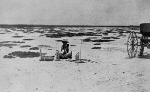 The first soil survey in California was the Fresno Area that was started in 1900 and was completed with horse and buggy. The 1900 Fresno report has many interesting photographs and a very interesting section on the Mima Mounds that occurred extensively in the survey area. Macy Lapham reported to Hanford in July 1901 to begin the Hanford Area soil survey with W. H. Heileman. (Lapham p. 23)
 The early Soil Surveys along with many other field endeavors of the time were all male field parties. A married woman might possibly accompany her husband on the trail and maybe do some cooking but was not a party member. A most unusual event for the time occurred during the Hanford Soil Survey in 1901. Macy Lapham received the first woman assistant assigned to a field Soil Survey in the United States. Miss Julia R. Pearce, a recent Agriculture graduate of Berkeley, arrived in Hanford in 1901 after direct appointment by the Secretary of Agriculture to the nearest soil survey to Berkeley, which at the time was Hanford. (P. 28, Crisscross Trails) Miss Pearce worked for a few months copying maps in the office without doing any field work and then was transferred to Washington as a lab assistant. There is some reference to Whitney thinking it a joke. Women were not to make significant gains in education for soil scientists until the 1950s, and placement on field soil surveys until the late 1960s and 1970s.
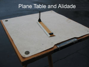
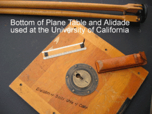 Macy Lapham and W. H. Heileman were transferred to the Salinas Valley in 1901 upon completion of the work in Hanford. During the survey in the Salinas Valley, Macy had his first experience with the use of the plane table and alidade to construct maps of landscape features and cultural features. Soil mapping units were drawn on the maps with colored pencils. Macy reports that the maps of the Salinas Area Soil Survey were without adequate controls because of large areas of Spanish and Mexican land grants, USGS topographic maps were not available for the area at the time. The Salinas Soil Survey was completed by the end of 1901.
In 1903 Macy returned to California and completed soil surveys in San Jose, Sacramento, Stockton and Bakersfield. These first soil surveys were rapidly completed, areas of mapping were small agricultural areas and the amount of soil property data recorded was limited. A first for the Soil Survey in California occurred in 1904 as the intrepid Macy attempted the first use of an automobile for transportation on any soil survey in the United States. (Lapham p 53) Macy succeeded in mapping some areas adjacent to the roads but eventually returned to the horse and buggy to let the automobile grow into a reliable means of transport.
 In 1906 and 1907 soil surveys were undertaken in Colusa, Glenn, Tehama and Butte counties. During this period W. W. Mackie was assigned to California to represent the Division of Soil Utilization in California. Mr. Mackie was instrumental in introducing rice culture to the dense salty clay soils of the southern Sacramento Valley. His experimental project was cut short but the incomplete results encouraged farmers to plant rice for the first time in the Sacramento Valley instituting a successful cropping of rice. (Lapham p.65) The survey at Colusa also produced another Soil Survey first in California, the use of a Soil Survey by county appraisers to properly evaluate the taxable value of farmland. The Soil Survey of the Colusa area formed the basis of a tax system formed by the Glenn County Board of Supervisors, at this time the Colusa area was part of Glenn County.
Macy Lapham was assigned as the Bureau of Soils Western Inspector for the Soil Survey in 1908. For the next 5 years, until 1913, the Soil Survey history trail gets a little cold in California as Macy Lapham was not in California very much. Several areas were surveyed during these years by the Bureau of Soils including Woodland, Madera and a larger area of Fresno. The period of the Bureau of Soils mapping in California without official cooperation from the State of California was about to end.


