By William Reed
Professor Charles F. Shaw
One of Professor Charles Shaw’s most lasting contributions to Soil Surveys in the field of education of soil scientists in California began shortly after he arrived in California. Around 1920, Professor Shaw initiated UC Berkeley Soil Technology 98, organized at first as a spring break trip to see firsthand the soils of California. In 1921, the Soil Technology 98 class, directed by Professor Shaw, produced a soil survey of the UC Berkeley Davis campus farm. Later the class traveled on the “milk trains” of the Sacramento and San Joaquin Valleys to study soils. Local farmers provided food and lodging to the group. [Ref Huntington 105 History] UC Soil Technology 98 evolved into the UC Soils 105 Field Course in the 1930s, earning international acclaim. Many of California’s soil scientists have received a thorough education in the immense variety of soils across the landscapes of California through the UC Soils 105.
California System of Soil Classification
The California System of soil classification was developed by Professor Charles Shaw. Gordon Huntington, a UC Davis soils lecturer from 1967 – 1988, stated “California soils are different and do not fit classification from anywhere else in the world.” (Huntington Oral History, Tape 1 side B.)
Professor Shaw published the first soil classification key (link to pdf) of the soils of California in 1927 in the proceedings of the First International Congress of Soil Science held at Washington D.C. Macy Lapham provided assistance and critical review of the California Classification Key. Data accumulated by Professor Shaw from Soil Surveys in California was used to provide groupings of soil series based on soil characteristics.
SCHEME OF SOIL CLASSIFICATION USED IN CALIFORNIA (link to pdf of this information)
I. ORDER (based on character of soil material)
A. Mineral Soils
1. Primary Soils (Residual Weathering)
2. Secondary Soils (from Transported Materials)
B. Organic Soils
II. CLASS (based on trend of reaction)
A. Sinecalcis (without lime-neutral or acid)
B. Cumcalcis (with lime accumulations-basic)
III. DIVISION (based on profile characteristics dependent on composition-chemical and mineralogical)
A. Soils composed of materials from disintegrated and decomposed igneous and metamorphosed igneous rocks high in quartz, “acid” igneous rocks
B. Soils… from…”basic” igneous rocks
C. Soils… from… sandstones and shales
D. Soils… from… limestones
E. Soils… from… mixed or undetermined rock sources
IV. FAMILY (based on character of fully matured profile)
A. Argillocompactum (claypans)
B. Ferrosaxeum (“iron” hardpan)
C. Calciferrosaxeum (“lime-iron” hardpan)
D. Calcisaxeum (lime hardpan)
V. STAGE (based on degree of development)
A. Solum crudum (Recent, unweathered)
B. Solum semicrudum (Young, slightly weathered)
C. Solum immaturum (immature, moderately weathered)
D. Solum semimaturum (semi-mature, strongly weathered)
E. Solum maturum (Mature, fully weathered)
VI. GROUP (based on color of surface soil)
A. Gray Soils
B. Yellow Soils
C. Brown Soils
D. Red Soils
E. Dark Soils
VII. SERIES (The unit of the classification. Soils uniform in all characters except texture of the surface soil.)
Six major classification groupings were established, order, class, division, family, stage, group and series that included 148 series of the Mineral order. Soil Order was simply Mineral or Organic. Suborders were established for Primary soils, developed in place and Secondary soils, deposited by water, wind, ice, etc. The Class of the soil was related to the reaction of the soils. Division was based on soil profile characteristics dependent on the composition of the soil material, five classes are based essentially on parent material rock type either high in quartz(acid) or rock type low in quartz(basic), sandstone and shale, limestone or mixed rock sources.
Family was a more difficult category to apply, families were subsoil features such as claypans and iron, lime iron or lime hardpans that were root limiting. Stage related to development of the soil profile, five categories were used, recent or unweathered immature soils, young soils, immature soils, semi mature and mature soils. Finally the Group was assigned based on the color of the surface soil. The soil Series embodied relatively uniform soil characteristics other than surface textures. Soil Type was a mapping unit based on all of the classification system plus surface texture and was not listed in the schema because it was only used for mapping unit naming.
The Families and Stages were unique creations of Professor Shaw specifically to address the large variability expressed in the soils of California. Apparently Professor Shaw had connected soil profile development with age. Dr. Marlin Cline writes in his Soil Classification of the United States that “The writer had an opportunity to see the “stages” of California in 1952 and found the examples exhibited quite convincing.” Dr. Cline continues that there were difficulties in determining the precise stage in some soils where soil morphology was not expressed so definitively. Such was the case for the early soil classification systems, for not until the enormous work of the 1950’s and 1960’s to produce Soil Taxonomy was a system devised that was flexible enough to grow with knowledge gained in soil mapping.
It is very interesting to compare Professor Shaw’s Classification Schema with the classification system under development by Dr. Curtis Marbut of the Bureau of Soils, also published in 1927 for the First International Congress of Soil Science.
TABULAR ARRANGEMENT OF SOIL GROUPS INTO CATEGORIES
by Dr. Curtis Marbut, Bureau of Soils, 1927
| CATEGORY VII | 1. PEDALFERS | 2. PEDOCALS |
| CATEGORY VI | 1. Podsolic Soils 2. Lateric Soils |
3. Pedocals of Temperate Zone 4. Pedocals of Tropical Zone |
| CATEGORY V | 1. Tundra 2. Podsols 3. Brown Forest Soils 4. Red Soils 5. Yellow Soils of Tropical Pedocals 6. Prairie Soils 7. Laterites 8. Ferruginous Laterites |
9. Northern Temperate Pedocals 10. Mid-Latitude Temperate Pedocals 11. Southern Temperate Pedocals 12. The various still unknown groups |
| CATEGORY IV | Sub-groups of Group 10 in Category V | 1. Tschernosem 2. Chestnut Colored 3. Brown 4. Gray 5. Sub-groups of Groups 9, 11, and 12 of Category V, none of which have yet received distinctive names. |
| CATEGORY III | 1. Soils with perfectly developed profiles. 2. Soils with imperfectly developed profiles. |
3. Soils with perfectly developed profiles. 4. Soils with imperfectly developed profiles. |
| CATEGORY II | 1. Soil Series Groups (a very great number) | 2. Soil Series Groups (a very great number) |
| CATEGORY I | 1. Soil units based on texture of surface horizon | 2. Soil units based on texture of surface horizon |
Professor Shaw’s Order separating mineral and organic soils does not appear in Dr. Marbut’s classification, it was certainly known at the time and Dr. Marbut may have determined this arrangement of classification to include only mineral soils. Professor Shaw’s class is apparently synonymous with Dr. Marbut’s pedocals and pedalfers. Soil genesis and morphology are reflected in both systems but at different levels. Professor Shaw’s Family for California’s claypans and hardpans is not reflected in this version of Marbut’s classification but later was proposed to be included at a very high level in the development of Soil Taxonomy.

1st Soils Congress – 1927: Group Photo in Lafayette, Indiana
The 1927 First Congress of Soil Science meeting in Washington DC, opened by a speech from President Calvin Coolidge, was followed by a 30 day train excursion around the United States and Canada. This special train of Soil Scientists had 11 Pullman cars and two dining cars. Most travel was at night and in the morning volunteer automobile brigades of local people took the soils scientists to their field sites. Foreign soil scientists rode the train free thanks to the US Chamber of Commerce. Professor Shaw, Macy Lapham and Dr. Walter Weir were among the 206 participants who traveled on a special train day and night and were met with locally provided transportation to soil sites. California hosted many stops. Dr. Hoagland was the regional representative from California and several other soil scientists including Prof. W.P. Kelley of the Citrus Experiment station, Riverside, E. E. Thomas Chemist of the California Experiment Station, Dr. P.L. Hibbard Chemist interested in Alkali reclamation and W.R. Webb Horticulturist from Los Angeles. This huge tour covered 12,000 miles by train in 23 states and 4 provinces of Canada. Another 1,500 miles was traveled at local stops to various destinations. A daily newspaper was penned on the train dubbed the “Boden Bull” with interesting and satirical comments. One comment on only the second day of the trip was that Professor Shaw never missed an opportunity to volunteer a solution for the riddle of the genesis of any soil profile.

1st Soils Congress 1927 – Group Photo in Canada
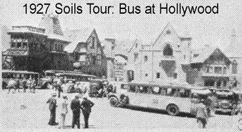
This grand excursion rolled into California on the 4th of July, 1927. The first brief stops were desert soils near Barstow, then Hanford soils were seen when the train stopped in Riverside. Near Fresno the excursionists examined the San Joaquin soils. Several other alkali affected soil profiles were visited near Fresno and experimental reclamation plots. That was about it for examining soils in California but time was afforded of course to visit Hollywood and stops at Berkeley for the UC Experiment Station and visits to San Francisco before the trained rolled north to Oregon.
In 1929, the University of California launched the Division of Soils, centered at Berkeley. UC had already been supplying soil scientists for Soil Surveys along with Bureau of Soils but now there was an official division for them at UC.
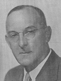
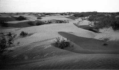
Dr. Stanley Crosby worked in 1920 on soil mapping near the Imperial Valley. The relatively recent importing of Colorado River water to the area opened up some of the desert to irrigation. There were playas with soils high in clay and usually salts, and some areas were simply too sandy for agriculture. But the warm winter climate allowed them to grow winter vegetables of high value.
 Sand dunes near the Imperial Valley |
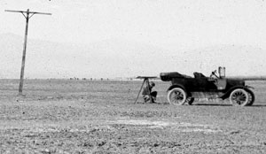
 Loaded with soil mapping equipment for the 1920 soil mapping near the Imperial Valley of California. |
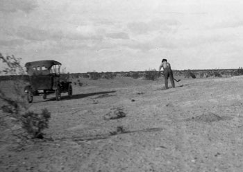
 Working with a plane table in 1920, in the Imperial Valley |
 1920 soil mapping near the Imperial Valley. |
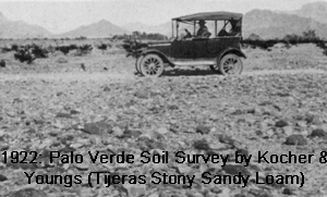 1922 Palo Verde Soil Survey by Kocher & Youngs (Tieras Stony Sandy Loam) |
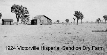 1924 Victorvill Hisperia: Sand on Dry Farm |
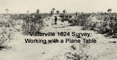 Victorville 1924 Survey: Working with a Plane Table |
 1927 Soils Tour in Hollywood, California |
 |
 |
 |
 |